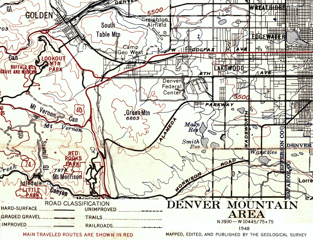
1948 Geological Map
This map from 1946 is great fun. One of the first things to catch the eye is the rectangular road that seems to track in the place of Union Blvd. along a canal, then west at about what is now Cedar all the way to Indiana, then north to 6th and then back to the start at about Union Blvd. Looking at the legend for "Road Classification", the double line is classified as "Improved" which for this map means a dirt road which would be suitable for a 2 wheel drive vehicle.
Were these roads part of Haden Ranch? Is there any remains to the canal along what is now Union? How about the railroad track along Rooney Road? And there is nothing at all where our neighborhood is? Not a sign of Alkire? Great fun.
If you click on this map, you will get a larger image. If you right click on the image here you can "Save image as..." so you can manipulate the image with your own software.