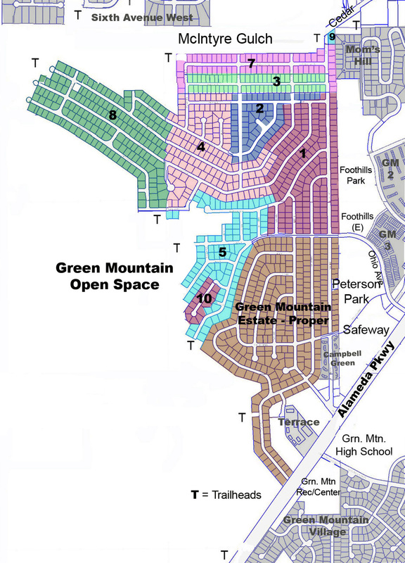
Color Map of Green Mountain (with some added history) (Last updated 5-10-2015)
|
subtitle: The Boundaries of Green Mountain Estates then and Now
Every now and then we come upon a nice map. This colored plate map was sent to us by Rocky Reynebeau. The fun part is seeing how our neighborhood grew in as fillings were added to the original Green Mountain Estates.
Now if we take a look articles in "Our History" we see:
"The area from Cedar to Ohio and from Alkire west was sold to us as GREEN MOUNTAIN FIRESIDE DIVISION. [Ed. Filing #1?] The rest of the division was known as GREEN MOUNTAIN ESTATES. I don’t know how the name on the stone at the beginning of Alkire came to be GREEN MOUNTAIN ESTATES, but when we first came here that was not the case. A man by the name of Mr. Kelly owned a lot of this mountain, and he put light poles, fire hydrants just where he thought they should go. The story goes that he did not go by code." (History - "Meet the Max's") And then in the article titled "1964" we see an unattributed contribution which states: "Her description was that Ohio was the dividing line. North of Ohio was "Fireside" and south of Ohio was "Green Mountain Estates". In Fireside, Richard Kelly was the man. The first house was occupied was in 1964. Back in those pre-incorporation days, Mr. Kelly was the law for his territory." She went on, "Green Mountianside (emphasis on 'side') was east of Alkire. It was a turkey farm. I suggested that Cedar was a dirt road on the Haden property. She didn't know the owner but did know that it was for turkeys!" |
This last is in contrast to GMCA's founding as Green Mountainside Civic Association in January of 1981. (Articles of Incorporation)
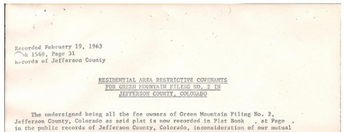
In any event, looking again at the early 1960's, the GMCA history page titled "1973, March - Murphy's move in, end of Cole Ct. development" we see an attachment of a covenants document that went with the sale papers.
In any event, looking again at the early 1960's, the GMCA history page titled "1973, March - Murphy's move in, end of Cole Ct. development" we see an attachment of a covenants document that went with the sale papers.
This was attached to the closing papers for a house built in 1972-73 and sold in 1973 to the current owners, the Murphy's. The house is in Filing No. 2 and is referred to as "Green Mountain". The document (see the history entry) was recorded in 1963, 10 years before the house was built. It was signed "Fireside Homes, Inc., A Colorado Corporation".
(Last updated 5-11-2015)
|
(c) Green Mountainside Civic Association, 2013-2019 CONTACT US SUBSCRIBE
Mailing Address: PO Box 280482, Lakewood, CO 80228 |
|


